Skip to the content
Environmental Integration & Infrastructure
Creating a Sustainable & Integrated Environment
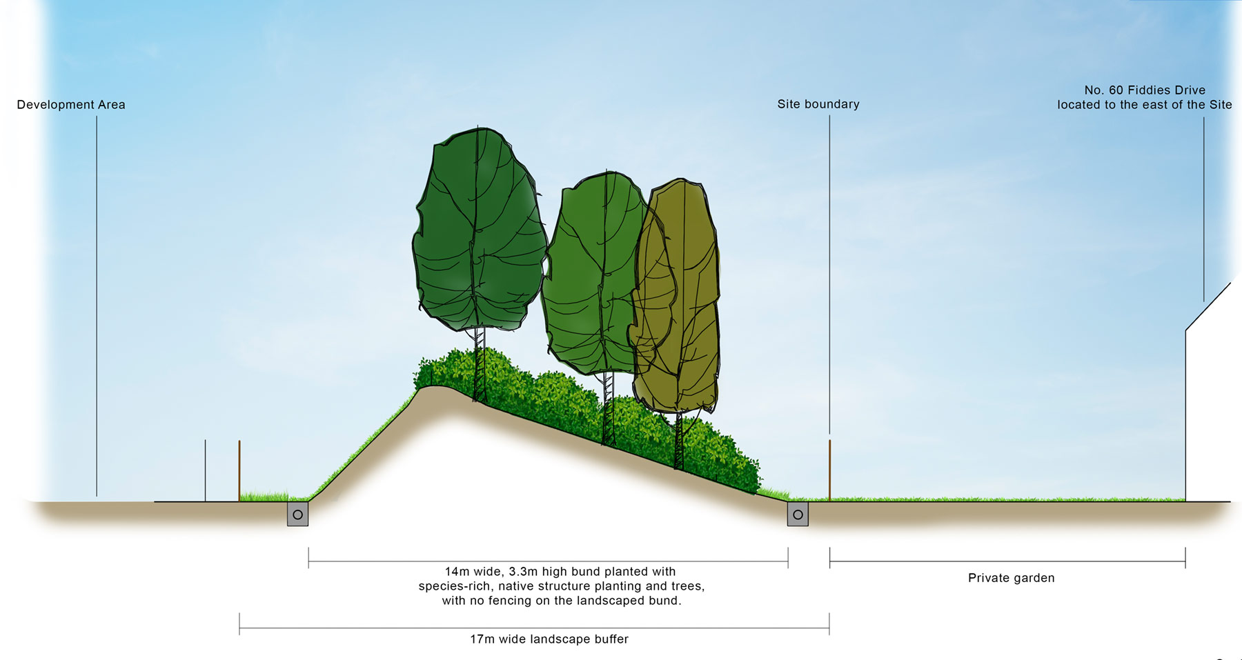
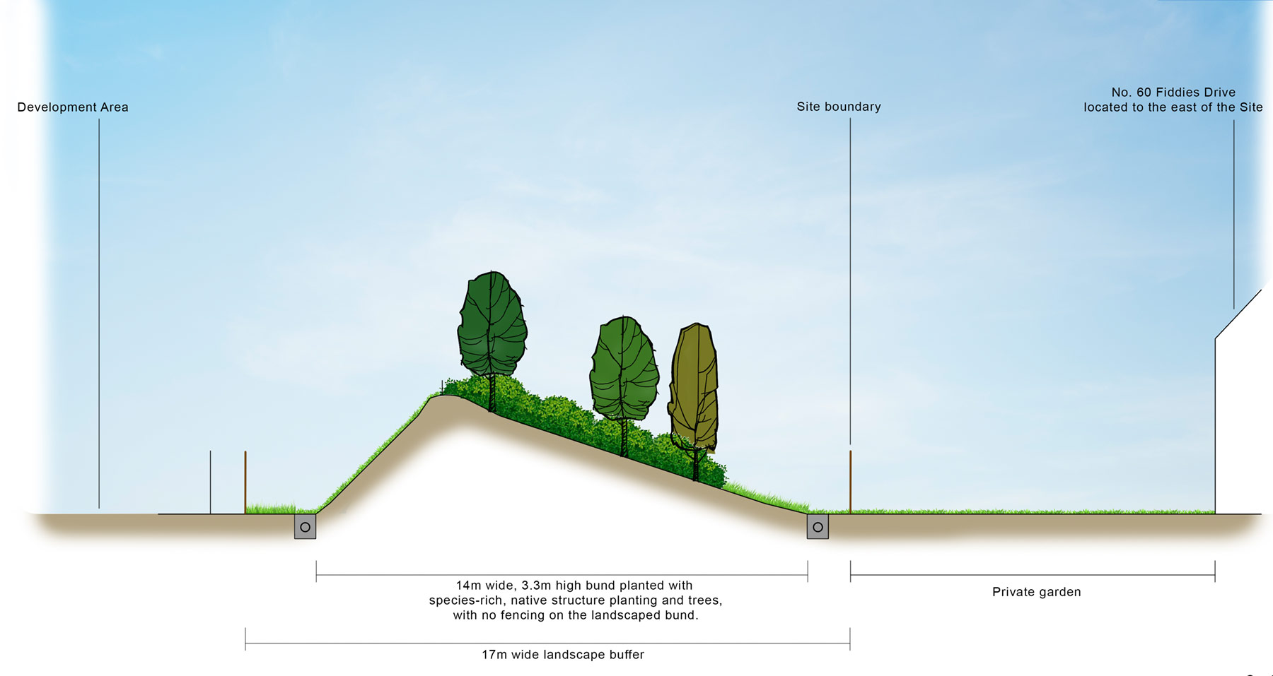
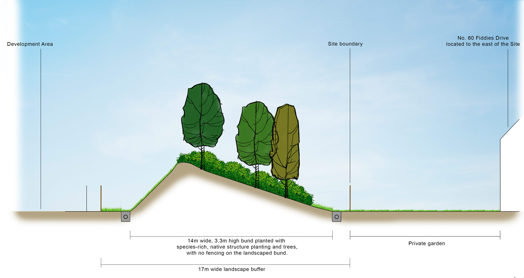
- Landscaping: Rula Developments is committed to sensitive design. By utilising boundary planting and significant strategic landscaping, the team aims to provide a visual buffer to residential properties and enhance the site’s environmental quality.
- While the site is reasonably level, some earthworks will be required to create development platforms, landscape buffers and drainage swales and attenuation features.
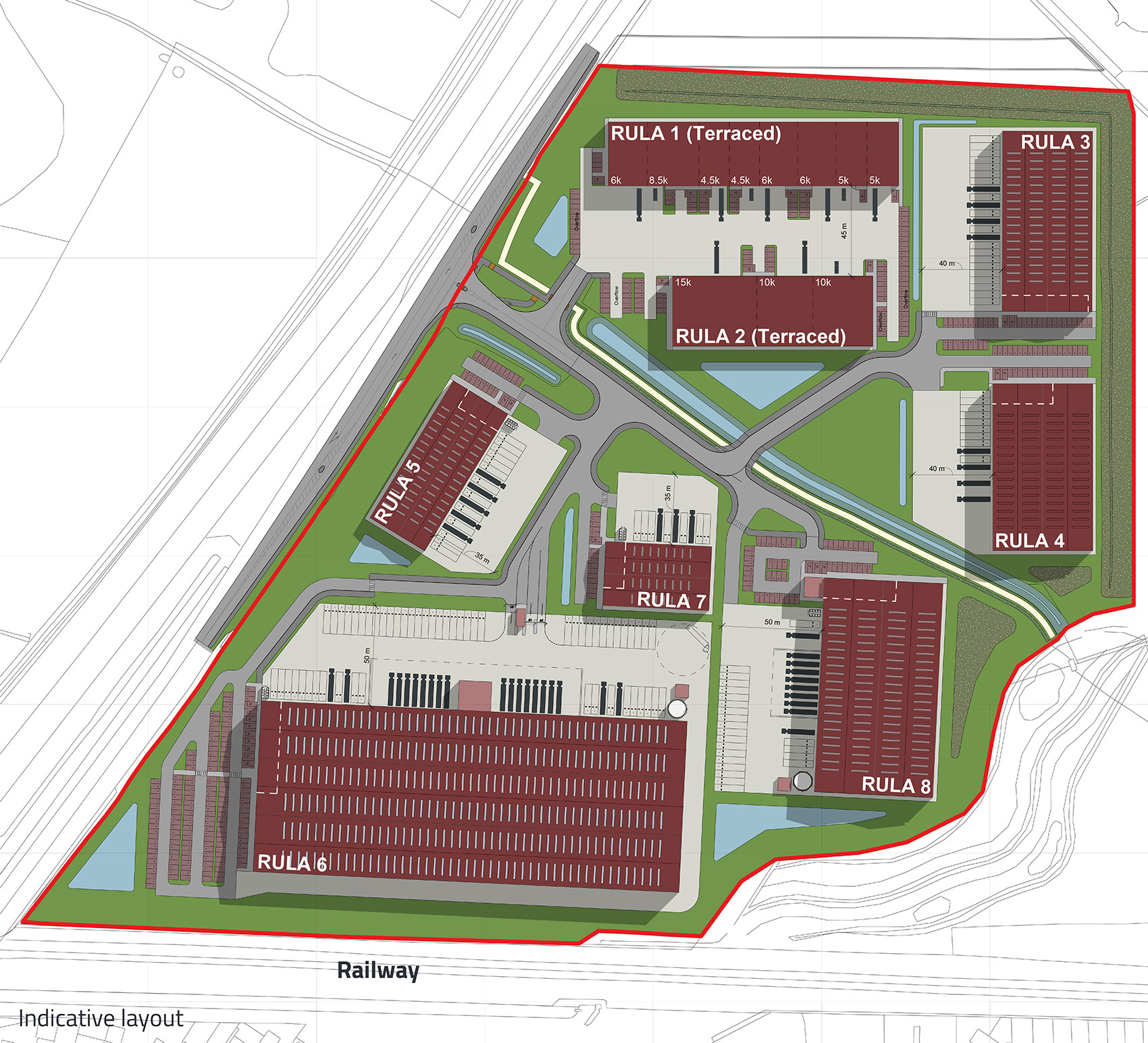
- Modern Infrastructure: The project will include the installation of essential drainage infrastructure, which has been designed to serve the whole site.
Masterplan
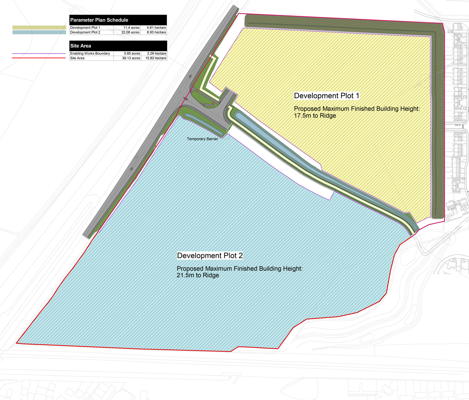
Plan showing different maximum height parameters for the two development plots
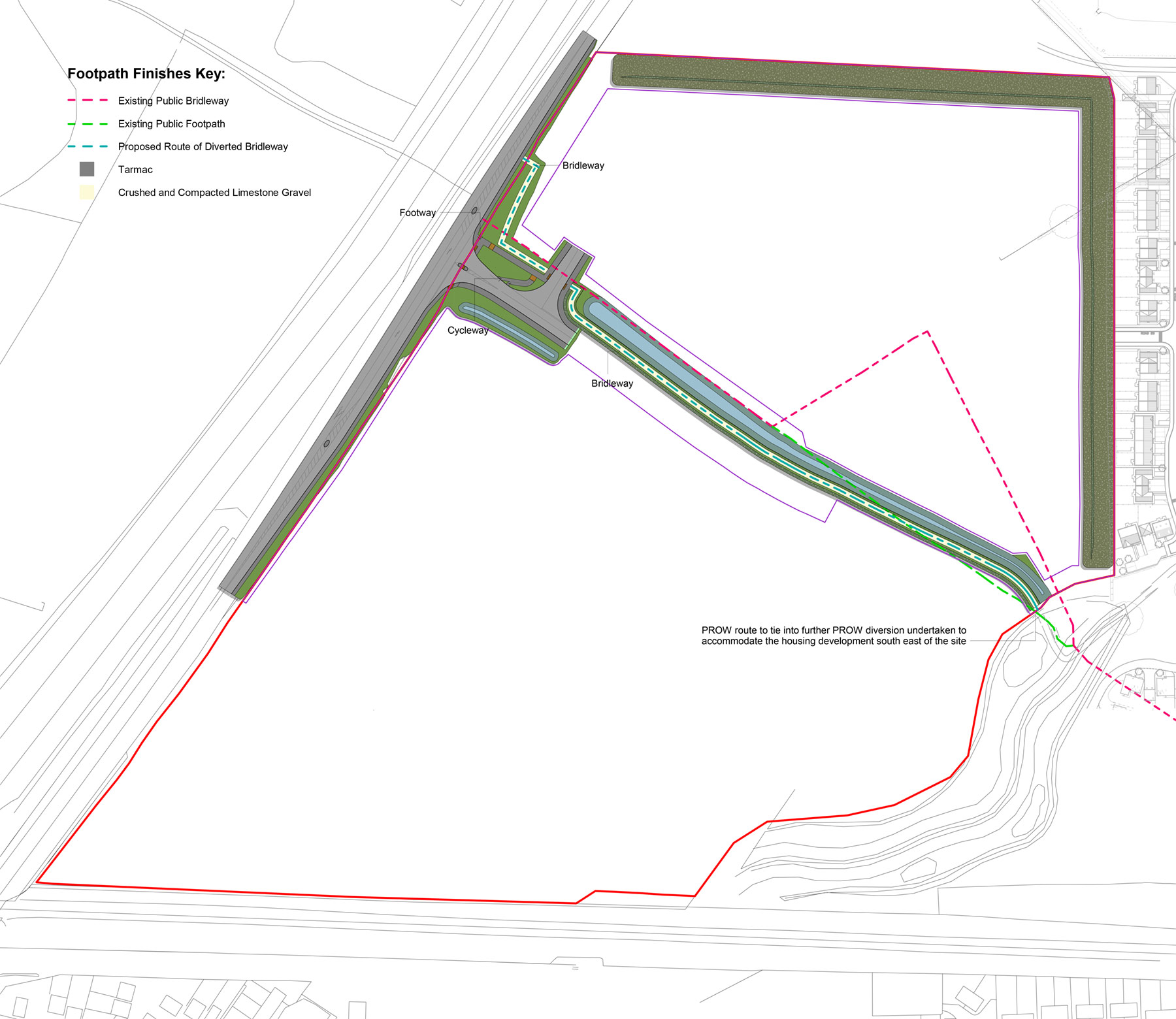
The hybrid planning application
Cross-section drawing of the proposed landscape bunding proposed for the northern and eastern boundaries (Fiddies Drive shown here). Showing expected planting growth at 1 year
Cross-section drawing of the proposed landscape bunding proposed for the northern and eastern boundaries (Fiddies Drive shown here). Showing expected planting growth at 5 years
Cross-section drawing of the proposed landscape bunding proposed for the northern and eastern boundaries (Fiddies Drive shown here). Showing expected planting growth at 10 years